Water Resources and Equity
SA Tomorrow
Water Resources and Equity
The NE I-35 and Loop 410 Area Regional Center Plan was adopted as a component of the SA Tomorrow Comprehensive Plan on September 1, 2022. Thank you for viewing the plan and sharing it with others.
To view the full, adopted plan, download this PDF: NE I-35 and Loop 410 Area Regional Center Plan (2022)
Water Resources and Equity
A History of the NE I-35 and Loop 410 Area Regional Center
As the Regional Center’s name implies, Insterstate 35 and Loop 410 have a significant presence in the area. Marveling at the loops and flyovers that form the highways’ massive interchange, it is interesting to note that what is present today is just the latest evolution of transportation networks in an area with a long history as a crossroads.
Pre-European Colonization
The earliest paths through the NE I-35 and Loop 410 area were made by animals in search of food and water offered by the creeks and rivers that flowed through the Texas prairie. Navtive Americans expanded these routes to incorporate seasonal camp sites, hunting areas, and villages. When Spanish explorers began arriving in the 1600s, they also followed the existing trails to navigate between what is today Mexico, Texas, and Louisiana.
1600s - 1800s: European Colonization and Settlement
During the Spanish Colonial era, the dirt trails were widened and improved to facilitate the movement of horses, wagon trains, soldiers, and settlers. As the Spanish established missions in South Texas, the trails became better-defined roads and were critical in linking far-flung outposts in Texas and Louisiana with Mexico City, the Spanish capital in the New World. Because these routes provided access to the Spanish capital, they were generally referred to as "caminos de realeza" (royal roads), with one regionally significant segment known as El Camino Real de los Tejas. Today, Nacogdoches and Bulverde Roads generally follow the same alignment as El Camino Real de los Tejas and are marked with commemorative National Park Service signage.
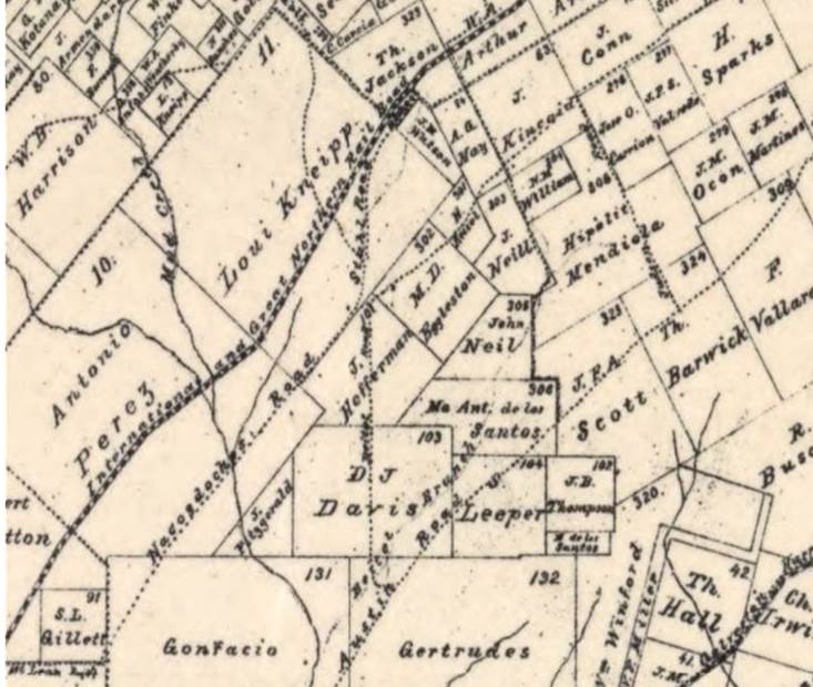
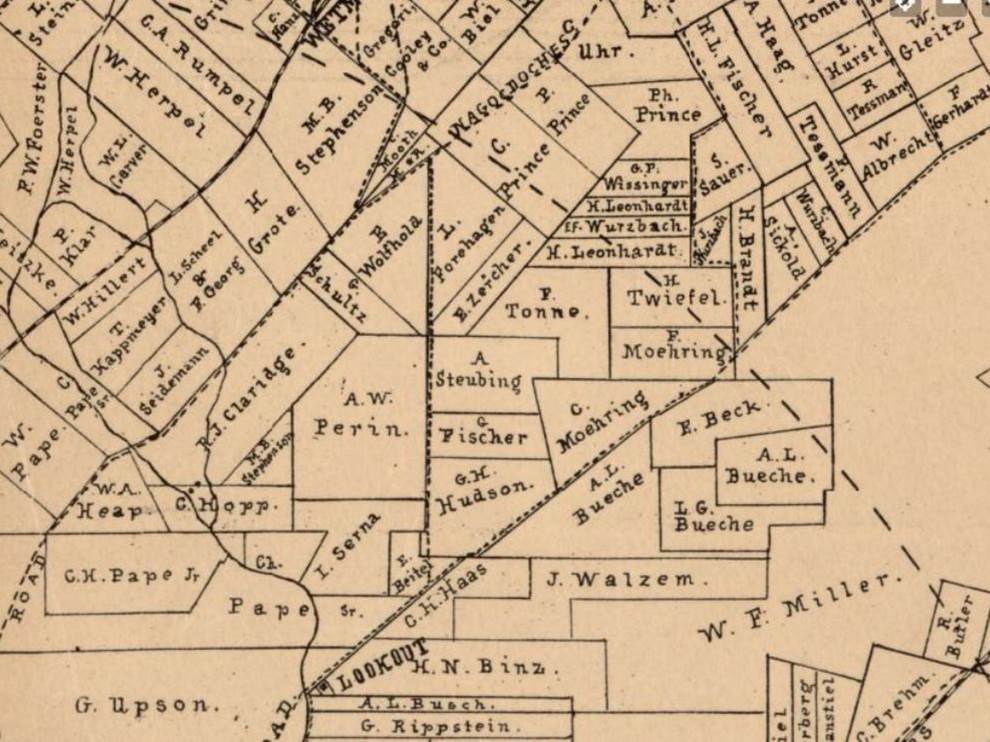
By the late 1800s, the lands comprising the Regional Center had been carved into farms and ranches by immigrants from Europe, particularly Germany. Many present-day street and place names, such as Perrin Beitel Road, Walzem Road, and Serna Elementary School, bear reference to some of these early landowners. Maps from this time period also show the early alignments of Nacogdoches Road, Austin Highway, and Perrin Beitel Road connecting farming communities and markets. Many of these routes were evolved from established trails. Statewide rail networks began crisscrossing the area with the arrival of the International & Great Northern Railroad (I&G) in the 1880s and later linked to national rail networks with the Missouri-Kansas-Texas (MKT) in 1901.
1900s - Present Day: Suburbanization
Small communities continued to grow around the area's rural crossroads and rail stops. The town of Fratt, TX was founded by German settlers prior to 1900 and became important as a flag stop station with the arrival of the MKT. Fratt was the MKT’s last stop before reaching San Antonio and, by the 1930s, the community boasted a general store, church, station house, and scandalously, a saloon that was rumored to be a brothel. The town of Fratt no longer exists; it was demolished to make way for the NE I-35 and Loop 410 interchange. Other small communities with similar fates include Longhorn Village, which housed workers from the Longhorn Quarry, and Short’s Corner, a crossroads community at the present-day intersection of Perrin Beitel, Nacogdoches, and Thousand Oaks roads.
After World War II, agriculture became less important to the economy of the area. San Antonio city limits expanded northward into the area starting in the 1950s and continued for the next two decades. With expansion came the need for better transportation networks; the age of the interstate highway had arrived. This would have a huge impact in changing the character of the Regional Center from rural to suburban. The NE I-35 and Loop 410 interchange was complete by the early 1960s. Portions of these highways follow the same alignments of several predecessor routes including Loop 13 and the Meridian Highway.


Water Resources and Equity
NE I-35 and Loop 410 Area Regional Center Plan Overview
The I-35 and Loop 410 Area Regional Center Plan is a long-term plan for the future. Thanks for taking the time to learn more about it and how you can be involved!
About
The NE I-35 and Loop 410 area is one of San Antonio’s emerging Logistics and Services Centers and a major catalyst for growth on the northeast side of the City. Click here to learn more about the NE I-35 and Loop 410 Area Regional Center Plan.
Process
Development of the Plan is approximately an 18-month process from Kick-off to City Council adoption. Staff from the Planning Department work with a wide range of community members that include neighborhood associations, business and property owners, employers, educational and cultural institutions, partner organizations, City Council Offices, and other City departments to create a realistic and implementable plan for this area. Click here to learn more about the different phases of the project.
Get Involved!
Sign up for our email list, learn about our upcoming community meetings and activities, review our project schedule, and leave your comments and ideas.
Tell us what you think.
Project Manager
Heather Yost McAllister
Project Manager
Heather.Yost@SanAntonio.gov210-207-7919
Meet the complete NE I-35 and Loop 410 Area Regional Center Planning TeamWater Resources and Equity
The SA Tomorrow Plan
San Antonio is planning boldly to ensure our great City captures the type of growth and economic development that will lead our community into the future and provide benefits to all our residents. Visit this website to learn more about the Comprehensive Plan and what we’re doing to make San Antonio a diverse and thriving community.